NASA finds a decades old landslide rapidly expanding in Los Angeles
A slow-moving landslide on the Palos Verdes Peninsula is accelerating, with new data from NASA’s Jet Propulsion Laboratory (JPL) showing significant ground movement following extreme rainfall in 2023 and early 2024.
NASA’s UAVSAR airborne radar instrument captured data in fall 2024 showing the motion of landslides on the Palos Verdes Peninsula following record-breaking rainfall in Southern California in 2023 and another heavy-precipitation winter in 2024. Darker red indicates faster motion. Credit: NASA Earth Observatory
Researchers at NASA’s Jet Propulsion Laboratory (JPL) in Southern California have discovered that the decades-old active landslide area on the Palos Verdes Peninsula has expanded.
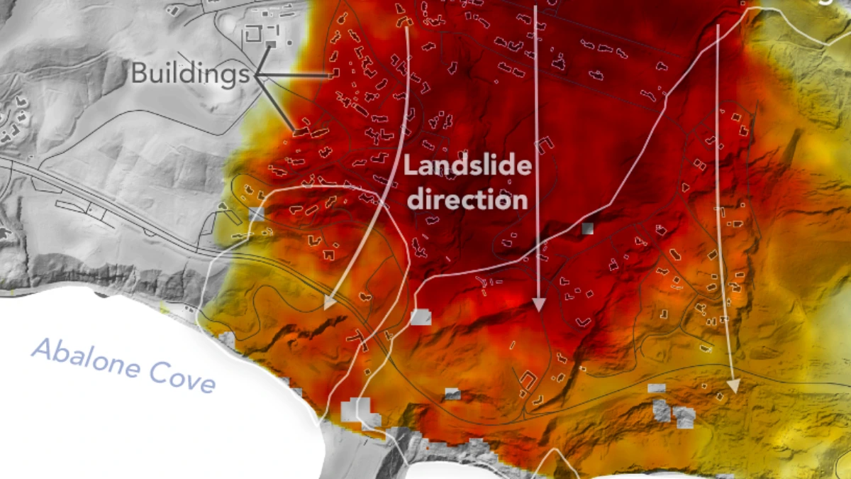
The discovery was made using data from airborne radar to measure the movement of slow-moving landslides on the Palos Verdes Peninsula in Los Angeles County. According to the analysis, land in the residential area moved toward the ocean at a rate of 10 cm (4 inches) per week between September 18 and October 17, 2024.
Parts of the peninsula, which extends into the Pacific Ocean just south of Los Angeles, are part of an ancient landslide complex that has been active for at least 60 years, affecting hundreds of buildings in local communities.
The movement accelerated, and the active area expanded following record-breaking rainfall in Southern California in 2023 and heavy precipitation in early 2024.
The colors in the image below indicate how fast parts of the landslide complex were moving in late September and October, with the darkest reds indicating the highest speeds. The arrows represent the direction of horizontal motion. The white solid lines are the boundaries of the active landslide area as defined in 2007 by the California Geological Survey.
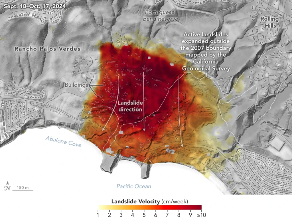
“In effect, we’re seeing that the area experiencing significant impacts has expanded, and the speed is sufficient to put human life and infrastructure at risk,” said Alexander Handwerger, the JPL landslide scientist who conducted the analysis.
References:
1 NASA Radar Imagery Reveals Details About Los Angeles-Area Landslides- NASA JPL – January 31, 2025

Rishav is a skilled researcher specializing in extreme and severe weather reporting. He combines exceptional research capabilities with scientific precision to deliver clear, data-driven articles. Known for uncovering critical information, Rishav ensures his work is accurate, insightful, and impactful. His passion for both science and literature fuels his dedication to producing high-quality news articles. You can reach him at rishav(at)watchers(.)news.
I wonder where I can get an interactive map of that area, so I can expand it and recognize some of the roads and landmarks.