Tropical Storm Chantal makes landfall over Litchfield Beach, South Carolina
Tropical Storm Chantal made landfall over Litchfield Beach, South Carolina at approximately 05:00 EDT (09:00 UTC) on July 6, 2025. It is the first hurricane of the 2025 Atlantic hurricane season to make landfall over the U.S. Coast.
Chantal made landfall in far eastern South Carolina, approximately 113 km (70 miles) northeast of Charleston, South Carolina and 137 km (85 miles) west-northwest of Wilmington, North Carolina. The storm had maximum sustained winds of 80 km/h (50 mph) and an estimated minimum central pressure of 1 004 hPa at the time of landfall.
As of 08:00 EDT (12:00 UTC), the center of Chantal was located approximately 24 km (15 miles) northwest of Conway, South Carolina and 129 km (80 miles) west of Wilmington. Maximum sustained winds reached 64 km/h (40 mph) as the storm moved north-northwest at 13 km/h (8 mph). It had an estimated minimum central pressure of 1 005 hPa.
Tropical-storm-force winds extended outward up to 129 km (80 miles), mainly over water to the southeast of the center. A Tropical Storm Warning was in effect from South Santee River, South Carolina to Surf City, North Carolina.
Tropical Storm Chantal is expected to produce heavy rainfall across parts of northeastern South Carolina on July 6 and across portions of North Carolina through Monday.
Rainfall totals of 51–102 mm (2–4 inches), with locally higher amounts up to 152 mm (6 inches), are expected. This heavy rainfall is likely to trigger flash floods throughout the region.
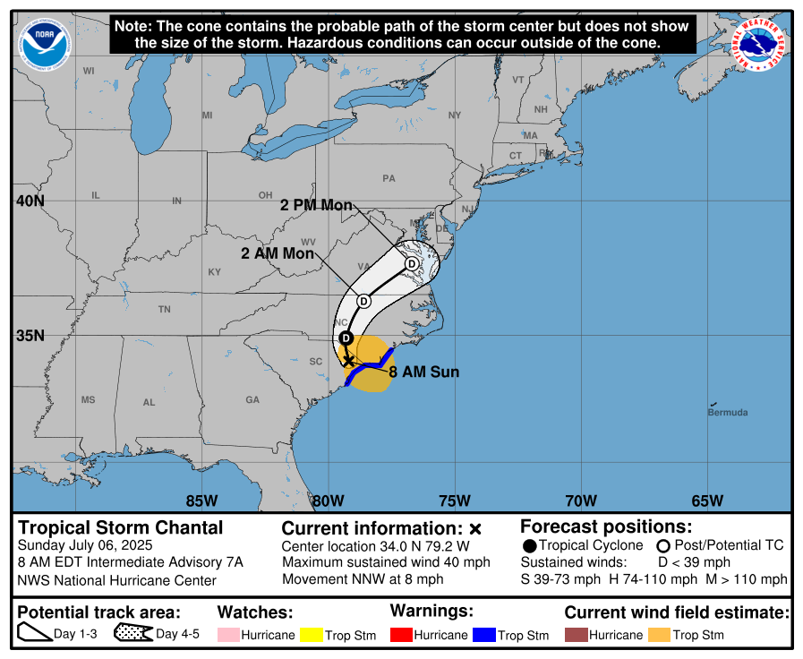
In addition, a combination of storm surge and tide is expected to cause normally dry areas near the coast to be flooded by rising waters moving inland.
A storm surge of 0.3–0.6 m (1–2 feet) will be possible from South Santee, South Carolina to Surf City, North Carolina.
Isolated tornadoes will be possible on July 6 across portions of eastern North Carolina and extreme northeastern South Carolina. Rough surf and potentially life-threatening rip currents are likely along beaches across the region.
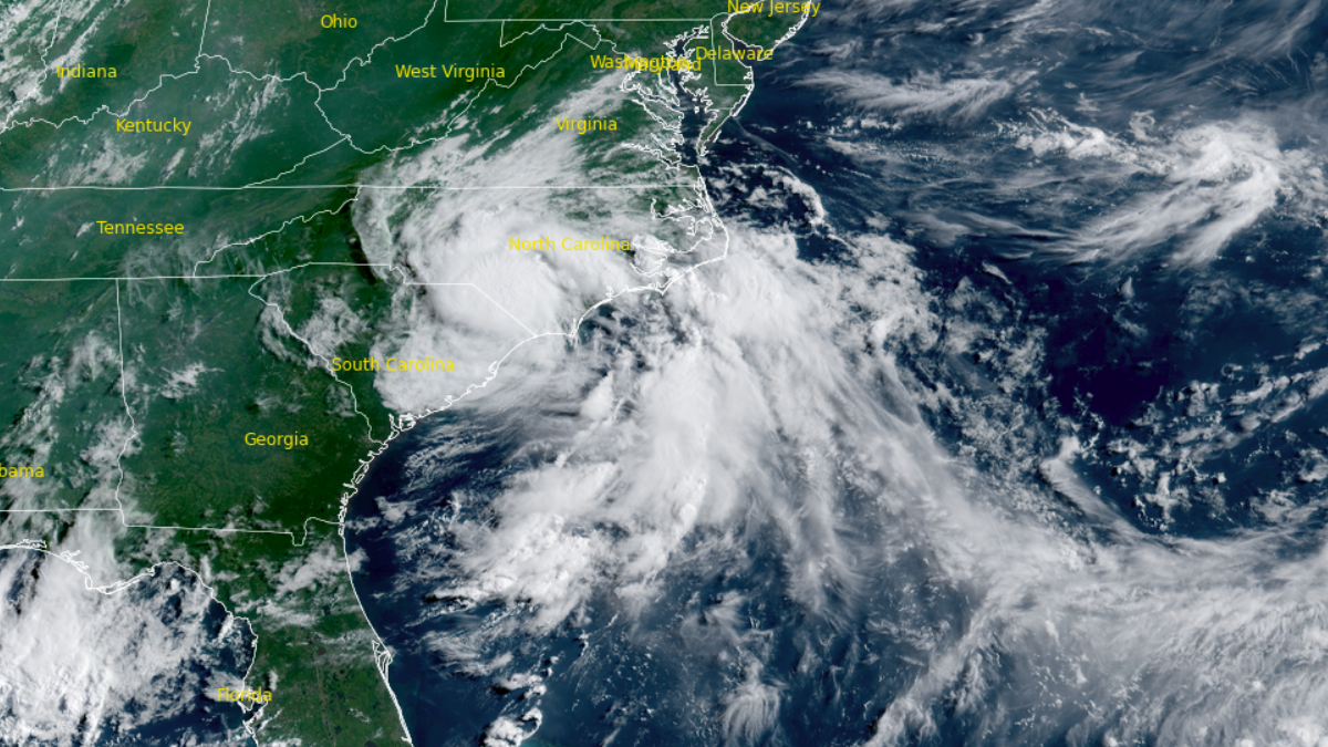
Featured image: Satellite image of Tropical Storm Chantal. Credit: NOAA/GOES-19, RAMMB/CIRA, The Watchers. Acquired at 13:00 UTC on July 6, 2025.

Rishav is a skilled researcher specializing in extreme and severe weather reporting. He combines exceptional research capabilities with scientific precision to deliver clear, data-driven articles. Known for uncovering critical information, Rishav ensures his work is accurate, insightful, and impactful. His passion for both science and literature fuels his dedication to producing high-quality news articles. You can reach him at rishav(at)watchers(.)news.
Commenting rules and guidelines
We value the thoughts and opinions of our readers and welcome healthy discussions on our website. In order to maintain a respectful and positive community, we ask that all commenters follow these rules.