Record-setting Atlantic storm Andrea dissipates within 12 hours of forming
Tropical Storm Andrea weakened into a post-tropical cyclone less than 12 hours after formation as the first named storm of the 2025 Atlantic hurricane season on June 24, 2025, and is forecast to soon dissipate on June 25. Andrea has set a new record as the farthest north and east a tropical system has formed in the Atlantic during June since 1851.
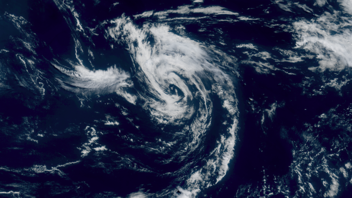
Satellite image of Tropical Storm Andrea. Credit: NOAA/GOES-East, RAMMB/CIRA, The Watchers. Acquired at 15:00 UTC on June 24, 2025
Tropical Storm Andrea formed on June 24 as the first named storm of the 2025 Atlantic hurricane season. It weakened quickly, becoming a post-tropical system less than 12 hours after formation, and is forecast to dissipate by the night of June 25.
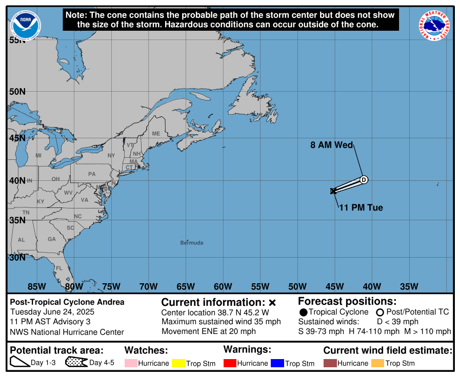
As of 03:00 UTC on June 25 (23:00 AST on June 24), Andrea was located roughly 1 585 km (985 miles) west of the Azores. Maximum sustained winds reached 56 km/h (35 mph). It had a minimum central pressure of 1 015 hPa and was moving east-northeast at 32 km/h (20 mph).
The system lacks deep convection, and is unlikely to redevelop as it traverses unfavorable cold waters. It is expected to continue moving east-northeast until it dissipates later on June 25.
While Andrea is not expected to have any impacts on land, it set a new record as the farthest north and east a tropical system has formed in the Atlantic during June since 1851. Andrea formed roughly 1 940 km (1 205 miles) west of the Azores on June 24.
NOAA’s outlook for the 2025 Atlantic hurricane season predicts a 30% chance of a near-normal season, a 60% chance of an above-normal season, and a 10% chance of a below-normal season.
The agency is forecasting a range of 13 to 19 total named storms (winds of 63 km/h (39 mph) or higher). Of these, 6 to 10 are forecast to become hurricanes (winds of 119 km/h (74 mph) or higher), including 3 to 5 major hurricanes (category 3, 4, or 5; with winds of 179 km/h (111 mph) or higher). NOAA has a 70% confidence in these ranges.

Rishav is a skilled researcher specializing in extreme and severe weather reporting. He combines exceptional research capabilities with scientific precision to deliver clear, data-driven articles. Known for uncovering critical information, Rishav ensures his work is accurate, insightful, and impactful. His passion for both science and literature fuels his dedication to producing high-quality news articles. You can reach him at rishav(at)watchers(.)news.
This kind of irrelevant ciclones have only start being catalogued as such less than 10 years ago. NHC would not have named a twelf hour storm going nowhere in the middle of the Atlantic in, say, 1995. Not to speak any year near 1851, when the records began, this perturbation would not have even being noticed by humans!!!!! So take this kind of “records” whith a pinch of salt 🙂